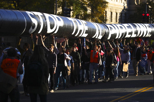
See here for Part 1 of this series on the constitutional issues raised by the lawsuit.
Nebraska Gov. Heineman slammed his fist on a table and raised his voice as he said, “Do you mean to tell me that the DEQ doesn’t know what they are talking about and they didn’t do their jobs?”
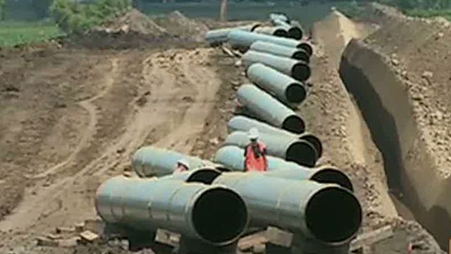
The governor was addressing a group of Holt and York County residents on February 2, 2012. Most had driven four-and-a-half hours to Lincoln to show him lab results from soil samples taken throughout the Keystone XL reroute that the state Department of Environmental Quality and TransCanada claimed had been “moved out of the Sand Hills.”
The landowners paid $600 of their own money to have 11 soil samples analyzed by Midwest Labs of Omaha. Amy Schaffer, daughter of rancher Bruce Boettcher, attempted to show the governor a PowerPoint presentation illustrating that soil on the north shore of the Elkhorn River—deemed outside the Sandhills by an EPA ecoregion map—was as sandy and porous as soil on the south shore of the river inside the area labeled Sandhills. Sample A, taken at the entry point of KXL into Nebraska, was an astounding 87.2 percent sand. The governor was unmoved.
“After that meeting, I kind of lost respect for him,” Schaffer said. “He has a very hot temper. I dressed in a suit, and I tried to be professional. I didn’t expect him to attack us at the beginning of the meeting like that. To me, it seemed as though he came in with his mind made up.”
At one point during the heated 90-minute meeting, Gov. Heineman reminded the ranchers he had authority to call out the National Guard to ensure that TransCanada would bury its pipeline on their land, regardless of whether they consented or not.
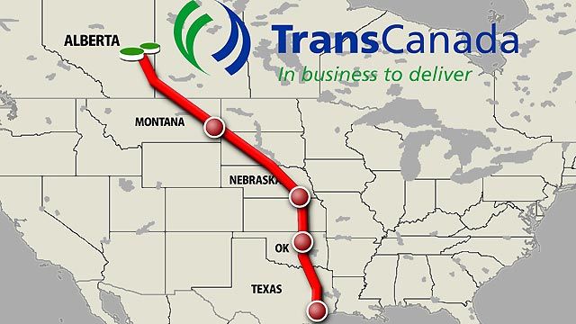
Susan Dunavan from York County and Susan Luebbe of Holt County were also at that meeting. Luebbe and Dunavan would eventually become the other two plaintiffs in Thompson v. Heineman, a lawsuit challenging the constitutionality of LB 1161, the pipeline-siting law passed in May 2012 that gave the DEQ and the governor authority to evaluate and approve Keystone XL instead of the Public Service Commission.
Luebbe owns a cattle ranch outside Stuart and still lives in the house where she grew up almost 50 years ago. Her parents have a ranch a few miles away. Speaking of the governor, she said, “We were in there showing him bags of sand from along the reroute. He acted like we came off Mars with this sand. We invited him to come tour it. His demeanor was like we were just a bunch of redneck hicks in his office. I gave up halfway through the meeting, knowing we were not getting anywhere.”
Luebbe returned to Lincoln in April for the final reading of LB 1161 in the legislature. “I was so appalled, watching our senators walking around, drinking coffee, not even listening to the final reading.” The bill passed 44-5. “We knew we going to sue,” she said.
According to Dunavan, “The attorney general, the governor and every legislator vows to defend the constitution of the state of Nebraska. They voted for this bill, and I believe they have violated their oath of office. I feel very seriously about this.”
If Thompson v. Heineman is decided for the plaintiffs, the reroute selected by the DEQ and approved by the governor could be set aside and a new route determined by the PSC under the provisions of a much more detailed bill, LB 1, passed during the special legislative session of November 2011. TransCanada and the DEQ claim the route was moved out of the Sandhills, but the plaintiffs and many residents who live in Holt County disagree.
Defining the Sandhills
During the special session, the U.S. State Department issued a press release on Nov. 10, stating, “…the Department has determined it is necessary to examine in-depth alternative routes that would avoid the Sand Hills in Nebraska in order to move forward with a National Interest Determination for the Presidential Permit.”
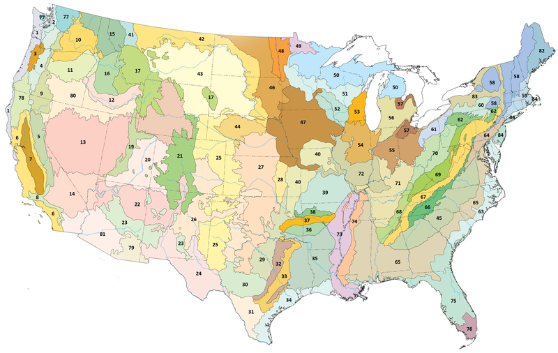
The legislature gave the task of defining the Sandhills to Nebraska’s DEQ. On December 29, 2011, the department provided Keystone with a map of the Sandhills, illustrated as Figure ES-2 in their January 2013 environmental impact statement. The EIS states, “The purpose of the Nebraska Reroute (the subject of this report) is to avoid the Sand Hills of Nebraska” (emphasis added).
The problem is that EPA and United States Geological Survey and UNL maps show different boundaries for the Sandhills. The DEQ’s definition relies on an EPA ecoregion map, level IV, that depicts the Sandhills (region 44) stopping abruptly on the southern shore of the Elkhorn River. The region north of the Elkhorn is classified as “42p—Holt Tablelands.”
Understanding an EPA Ecoregion Map
Jim Omernik was part of the team that created the EPA ecoregion maps of the United States in the 1990s. Omernik has been employed by the federal government for 55 years and has worked for the Defense Intelligence Agency, the Environmental Protection Agency and, currently, part-time for the USGS.
He explains, “The ecoregions are intended for ecosystem management. They are looking at the ecosystem as a whole—with humans being a part of it.”
Omernik defines ecosystem management this way. “…In the broadest sense of the word, you are not managing for soils, or vegetation, or biological diversity, or water quality or any one thing. All of those things are interrelated, so you are concerned about the whole rather than the parts.”
Holt Tablelands (42p) north of the Elkhorn River was split off from the Sandhills (44) partly because it looks different—it is flat as opposed to rolling, and the vegetation is different. Crops are grown there. By contrast, the Sandhills are the largest area of grass-covered sand dunes in the world and are not suitable for crops.
Human activity has changed the Holt Tablelands from its natural state. According to lifetime Holt County resident Bruce Boettcher, “Fifty or 60 years ago, you would not have seen any farming out there. Ninety percent of it would have been grassland, short buffalo grass. Man has developed that into cropland because of irrigation. But, the soil is just as porous and gravelly as the Sandhills so water goes through it just as fast,” he said.
Understanding a USGS-defined Map of the Sandhills
USGS maps confirm Boettcher’s claims. Beneath the surface of the land, what is not visible to the eye, is that the Ogallala Aquifer underlies both the Sandhills and Holt Tablelands. (The Ogallala Aquifer is also known as the High Plains Aquifer and is split into three regions: southern, central and northern.) The soil permeability on both sides of the Elkhorn River is identical—water flows through it rapidly at rates between 5 and 10 inches per hour. (See Figure 5, “Groundwater Quality of the Northern High Plains Aquifer, 1997, 2002–04” by Jennifer Stanton and Sharon Qi, USGS.)
According to lead author Jennifer Stanton, she defined the Sandhills based on hydrogeologic units using a Geologic Regions map published by the University of Nebraska. That map is also shown in a publication titled, “The Groundwater Atlas of Nebraska” (Resources Atlas No. 4a, 1998), published by the UNL Conservation and Survey Division. These maps show the northern border of the Sandhills extending to a point midway between the Elkhorn and Niobrara rivers.
No matter which map is used, KXL’s reroute is still over the Ogallala Aquifer.
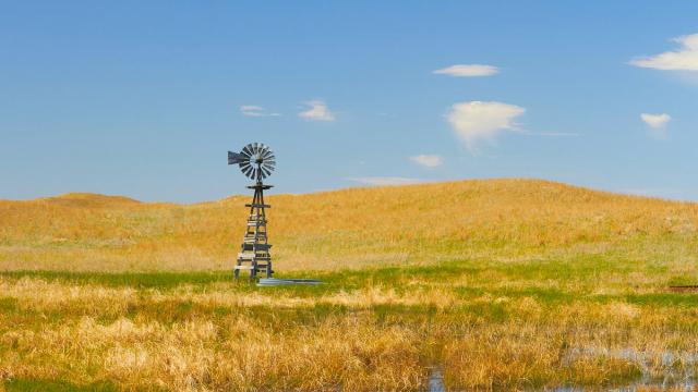
One of 40-plus water troughs provided by a high water table and a windmill on Susan Luebbe’s ranch. (Greg Rohde) TransCanada used the USGS and UNL hydrogeologic map of the Sandhills in its first application for a permit. Now, it prefers the smaller area defined by the EPA ecoregion map. According to Jim Omernik, “The boundaries are not ones that you step across.”
What is the best map to define the Sandhills for the purpose of siting a tar sands pipeline beneath the ground? One that relies on a broad range of characteristics, many above ground? Or one developed specifically to consider characteristics beneath the ground, including soil composition, permeability and depth to groundwater? The DEQ-defined Sandhills map is one of many reasons the plaintiffs want KXL’s reroute to be reevaluated by the Public Service Commission.
The EPA also criticized KXL’s reroute over the aquifer in an April 23, 2013 letter to the U.S. State Department, stating that the Interstate 90 alternative “would further reduce the potential for adverse impacts to critical groundwater resources.”
A Visit With “the Susans”
Susan Luebbe and Susan Dunavan could not be more different. The 45-year-old Luebbe is going through a divorce and runs a 4,200-acre ranch in the Sandhills supporting 1,200 head of cattle, largely by herself, with help from her parents and hired labor. Much of her time is devoted to the herd. On the day of our visit she spent the morning castrating and branding three-month-old calves. When we stepped out of our vehicle, she told us that three tornadoes had touched down to the south, so if we wanted to see the property, we should do it before the rain started. Luebbe knows firsthand what it’s like to outrun a tornado. An F-4 touched down on her ranch while she was out in the field with her daughter in a pickup truck. Huge cottonwoods trees, felled by the storm, still lay on the ground like large sculptures. Her life looks hard, but it’s obvious she loves it.
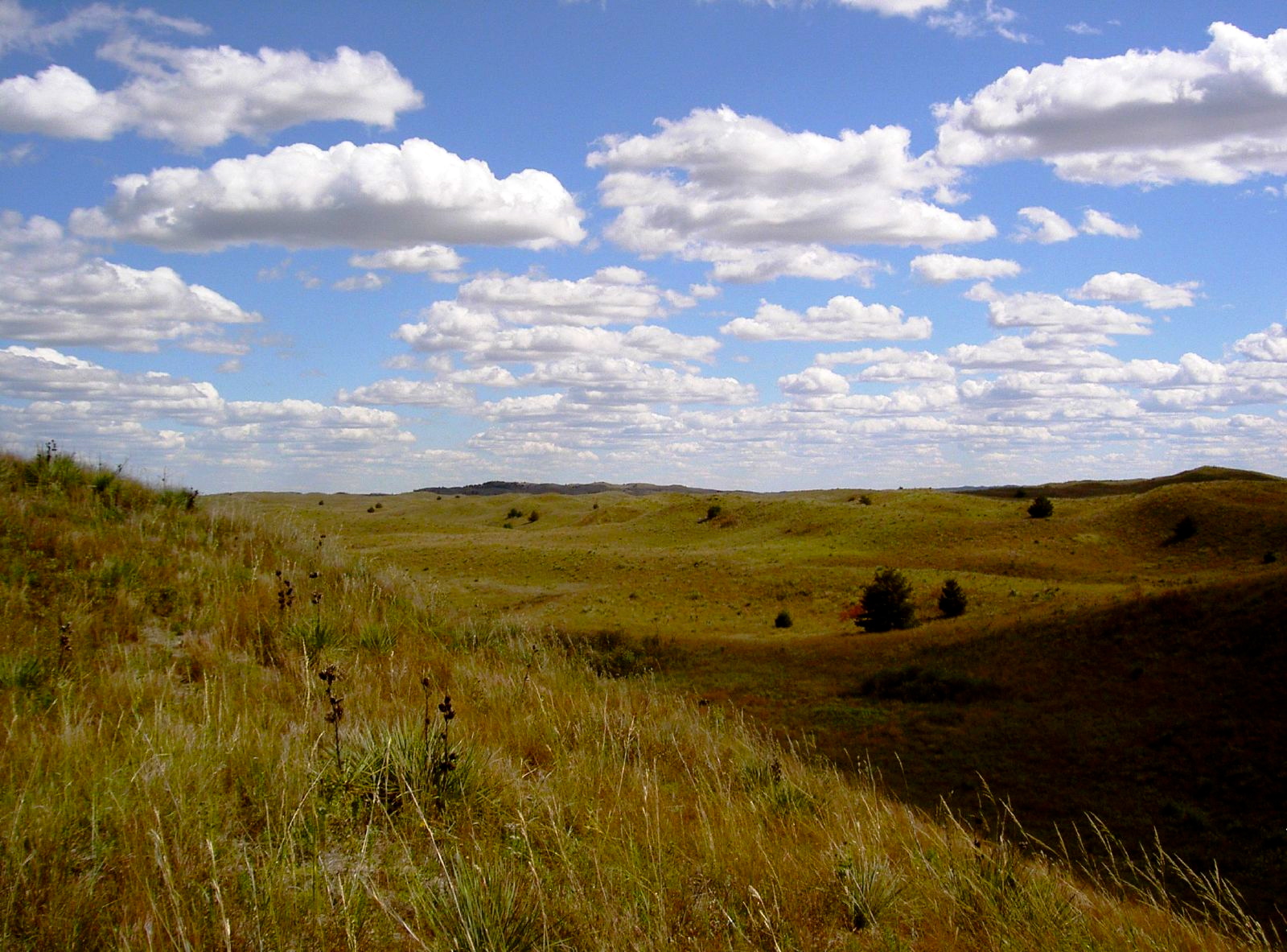
Keystone XL will cut across a quarter-mile of Susan Dunavan's native prairie grass pasture in York through the middle of this photo.
Luebbe, like plaintiff Randy Thompson, is no longer on KXL’s route, but she refuses to give up the fight. “I would not be satisfied to see the pipe moved further east. I want Keystone XL stopped. Those people in Alberta who live in the tar sands region are coming down with strange cancers. Tar sands mining poisons the land and water. This is not something we should develop,” she said.
Dunavan is the one plaintiff whose farm is still on the proposed reroute.
She is a grandmother in her 60s who lives with her husband on 80 acres of native prairie in York County, west of Lincoln, in a beautifully renovated farmhouse with cathedral ceilings, surrounded by fruit trees, vegetables and flowers. “It’s like an oasis,” she said. Her husband is a crop consultant whose business involves working with farmers to protect their land through sustainable agricultural practices. The Dunavans have 19 three-ring binders on their dining room shelves containing five years’ worth of documents related to their fight against KXL.
Liability—Will KXL Cost Landowners Money?
Dunavan prefers not to divulge the exact amount of money TransCanada offered her for an easement. “It is enough to buy a used car,” she explained.
But is it enough to cover the future stream of costs to the Dunavans once a tar sands pipeline is buried across a quarter-mile of their pasture?
TransCanada told Susan Luebbe she should increase her liability policy to $2 million to cover damage to her property in the event of a spill. Her insurance agent was not sure he would cover liability for damage from the pipeline in the first place, but gave her a ballpark figure of an additional $3,000 or $4,000 per year for her policy. The Dunavans were not told to increase their liability, but they did ask their banker if it would affect their ability to get a loan. He indicated their loan would be stamped “HAZARD” and they would be charged a higher interest rate.
“It’s become about more than just protecting our native prairie,” Dunavan said. “The issues are so complex, I don’t even know where to begin.”
Crude oil pipelines are required to pay seven cents per gallon into an oil spill trust fund to cover the costs of a cleanup. However, Keystone XL is not required to pay into this fund because tar sands are technically not crude oil.
A hearing for the lawsuit on July 19 in district court in Lancaster County will set the schedule for trial. Two attempts by the state to dismiss the lawsuit have been overruled by Judge Stephanie Stacey.
3 WAYS TO SHOW YOUR SUPPORT


- Log in to post comments


